 | TechnoLogical is a weekly blog focusing on new advances in science and technology and looking critically at how the technology we already use impacts our lives. Come back next Monday for the next edition of TechnoLogical. |
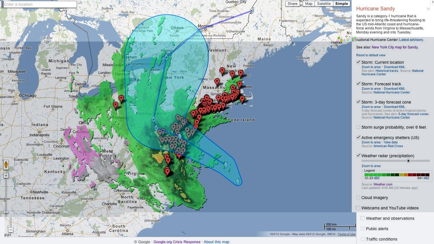
The Google Interactive Map displays Hurricane Sandy's path. Photo courtesy of the Business Insider.
By now you're probably wondering why this is in the technology section of Silver Chips Online. Well, Google's Crisis Response team has launched the Interactive Hurricane Sandy Crisis Response Map. This not only helps the average person understand the science behind the super storm, but it also presents a view of Hurricane's Sandy's path, its current location, storm surge probability, public alert zones, traffic conditions and Red Cross safety shelter locations that are marked by red pins.
The interactive map includes clickable locations and the predicted times that Sandy will hit an area. It also includes a side bar, located on the right, that includes related YouTube videos, weather observations and cloud imagery. The most important features on the bar that pertains to safety are the emergency shelters, and the public alerts. It's pretty much an online interactive version of "Hurricanes for Dummies".
The coolest feature on the map is the webcam that takes real-time photos of Sandy. The photos come from already installed webcams. The information on Google's Interactive Map comes from the Weather Channel, the National Oceanic and Atmospheric Administration, the National Weather Service and the US Naval Research Laboratory.
Some other great, informative websites that you can check out if you want more information are the National Weather service, which also has public service announcements and updates, Weather.com, which is always good for forecasts and the Federal Emergency Managing Agency, which can better inform you to be prepared for the hurricane.
Stay safe and enjoy your days off Blazers. Thanks again, Sandy.
Melissa Arias. More »
Please ensure that all comments are mature and responsible; they will go through moderation.
